
Sacred Way – Historic Route
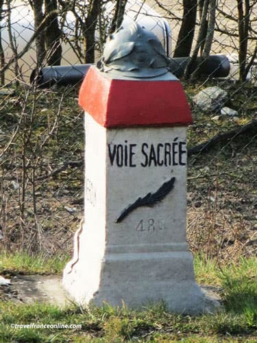
President Raymond Poincaré inaugurated the Sacred Way -Voie Sacrée on August 21, 1922.
The Voie Sacrée is not just any road, as it played a crucial role in transporting troops and supplies during the Battle of Verdun in 1916!
Named so by Maurice Barrès in 1916 after the ancient Roman Via Sacra, it evokes the triumphal route of Roman generals returning from their victories to Rome.
It was designated a National Route until 2006, when it became the Departmental Route RD1916 to commemorate the year 1916.
It is marked by milestones adorned with helmets from the First World War which bear the inscription “NVS” (National Sacred Way).
The Sacred Way connects Bar-le-Duc to Verdun, forming an important north-south axis in the Meuse department.
Sacred Way, the logistics center of the Battle of Verdun
The Sacred Way proved to be an exceptionnal logistical and strategic hub, a vital communication route that linked the front lines during the Battle of Verdun!

The citadel of Verdun was indeed encircled by the Germans in 1914, isolating it fully at the heart of a salient. As a result, the main French lines of communication had to cross the German lines, directly exposing themselves to enemy fire.
It became imperative for the French to open an access route to the front! The man responsible for this route was General Doumenc. In February 1916, on the eve of the deadly Battle of Verdun, Doumenc realised the urgent need to bypass the enemy lines and bring reinforcements and supplies to Verdun.
He calculated that a dedicated access road would allow the safe transport of 2,000 tons of supplies and 12,000 men daily.
Thus, he organised transport by creating the ingenious and highly effective Taxis of the Marne operation. He requisitioned Parisian taxis to transport infantry reinforcements from Paris to the Battle of the Marne on September 6 and 7, 1914.
Construction of the Sacred Way
Thus, teams of workers toiled tirelessly, day and night, month after month, on the construction, maintenance, and reinforcement of this vital communication route, through which thousands of soldiers, supplies, and equipment passed!
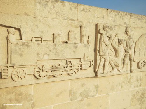
They worked alongside quarry-men, who extracted the stones needed for the road’s foundations from quarries they had opened along its banks.
Various tradespeople, including mechanics and blacksmiths, were also essential.
All these individuals transformed the neighbouring villages into a vast construction site!
The Voie Sacrée – Sacred Way had also to be protected from German air attacks, a mission entrusted to the pilots of the French Air Force.
The road operated 24 hours a day to ensure the rapid rotation of troops to the front, particularly for the arrival of reinforcements and a constant supply of food, weapons, and equipment.
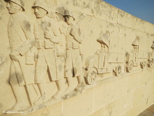
The troops arrived by train in the neighbouring village of Baudonvilliers.
They were then transported by truck (every 14 seconds, or every 5 seconds if necessary) to Moulin-Brûlé, in the commune of Nixeville.
From there, they reached the front, covering the last 8 kilometres on foot, at night, carrying their equipment.
Moulin-Brûlé was located at the crossroads of the roads connecting Verdun to the Argonne and Bar-le-Duc. This crossroads had been specially redesigned to facilitate truck traffic. The troops nicknamed it Le Tourniquet – The Turnstile.
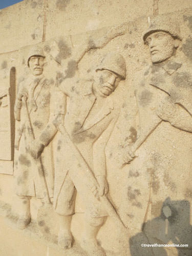
A first-aid post, staffed by two doctors and two nurses, was set up there to facilitate the evacuation of the 800,000 soldiers wounded during the six months of the battle. The wounded were evacuated by various means: trucks, horse-drawn carriages, cars, trains, stretchers, or simply on foot, depending on the severity of their injuries.
Every day, three trains, each with a capacity of 300 men, departed from Maison Rouge, a small station located 2 km from Verdun.
Although the Voie Sacrée – Sacred Way was in operation 24 hours a day, it was reserved exclusively for convoys. Any vehicle that broke down was immediately impounded to prevent traffic jams.
During the summer of 1916, approximately 90,000 men and 50,000 tons of equipment and supplies travelled along this route. Seventy of the 95 French divisions that participated in the Battle of Verdun relied on the Voie Sacrée for their transport.
Sacred Way Memorial
The Moulin-Brûlé crossroads (Le Tourniquet) was the departure point for troops travelling to the front by truck, making it an ideal location for a memorial. The monument, commissioned by the National Railway Federation at the request of Lorraine railway associations, was inaugurated on May 14, 1947. It pays tribute to the men who, day and night, worked tirelessly for months to ensure the continuous transport of troops, food, weapons, and equipment to the front lines.

Designed by the sculptor Barrois and the architect Schmitt, the monumental structure consists of a vaulted wall of white stone, centred on an obelisk.
A frieze of bas-reliefs adorns its entire length, depicting the soldiers and the various means of transport used on the Sacred Way. The centre of the frieze is inscribed with a dedication from railway associations to their veterans: “Le train à ses anciens, à tous ceux de la Voie Sacrée – The train to its veterans, to all those of the Sacred Way.”
A winged wheel, the emblem of the French railway network, crowns the top of the obelisk. A commemorative plaque was added in 2007 to mark the bicentenary of the railway network’s logo.
The Moulin-Brûlé plateau offers an impressive and exceptional panoramic view of the surrounding area, and a viewpoint indicator helps identify the former sectors of the Battle of Verdun.
Access to the site is free.
Other sites of the Battle of Verdun:
Citadel of Verdun – Douaumont Ossuary and National Cemetery – Abri 320 – Bayonet Trench– Fort of Douaumont – Fleury-devant-Douaumont “Village Détruit – Maginot Monument in Fleury-devant-Douaumont
Department of Meuse – Grand Est region
Coordinates: Lat 49.123286 – Long 5.295498


