
River Bièvre, once a source of ice!
Our Gallic ancestors called the Bièvre River Befar (from the Gaelic word for “beaver”).
This small river, 36 kilometres long, rises near Guyancourt, not far from Versailles in the Yvelines department, and flows into the Seine near in Paris near the Austerlitz train station.
For centuries, the Bièvre meandered through meadows and woods along the marshy left bank of the Seine. In spring, it often overflowed its banks, before returning to its course a few months later.
The vast expanses of water thus formed froze during the harsh winters of yesteryear, transforming into impromptu ice rinks.
These ice reservoirs also served a practical purpose: the ice was harvested, cut into blocks, and stored in deep pits covered with earth. This ice was then used during the summer to preserve food and drink.
The souvenir of this large area, once prone to flooding and ice, lives on in the name of the Glacière metro station, on Boulevard Auguste Blanqui.
River Bièvre, the Gobelins River
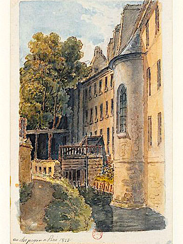
At the end of the 14th century, the appearance of Left Bank changed with the arrival of the Flemish dyer Jean Gobelin, who established his workshops along the Bièvre River, which soon became known as the Rivière des Gobelins – Gobelins River. The expansion of the Gobelins workshops naturally led to the establishment of ancillary industries: slaughterhouses, butcher shops, tanneries, and leather industries.
Unfortunately, these industries dumped their waste directly into the river, transforming it into a veritable cesspool of stench. The Bièvre flowed down the slope beneath Rue Mouffetard, then reached the flat ground by passing under the Pont aux Tripes (Bridge of Tripe), a name that speaks for itself! Rue Mouffetard, now affectionately nicknamed “La Mouff” and renowned for its quintessentially Parisian atmosphere and daily market, was then exposed to the pestilential odours emanating from the polluted river. Its name evolved in fact from the slang term “moffettes,” referring to foul odours.
The establishment of factories and workshops fostered the urbanisation of the neighbourhood. Open-air cafes and restaurants sprang up along the banks of the Bièvre River, primarily catering to Flemish workers from the Gobelins Manufactory and those working in the surrounding factories. Amazingly, these popular establishments gained a certain renown for the quality of their beer. Numerous watermills, such as the Moulin des Prés and the Moulin Jehan-de-la-Crolle, were also built along the Bièvre.
Over time, and with the growing fame of the Gobelins Manufactory, the number of tanneries and other artisanal industries, such as distilleries, laundries, and factories producing gunpowder, paint, starch, paper, and cardboard, increased, contributing further to the pollution of the Bièvre . Thus, in the 19th century, the river was nothing more than a repugnant open sewer, considered a serious public health problem. Urgent intervention was necessary!
River Bièvre today
Fifty years of development efforts culminated in 1910 with the regulation of the Bièvre River’s flow. To combat pollution, the river was entirely channelled underground and integrated into the Parisian sewer system.
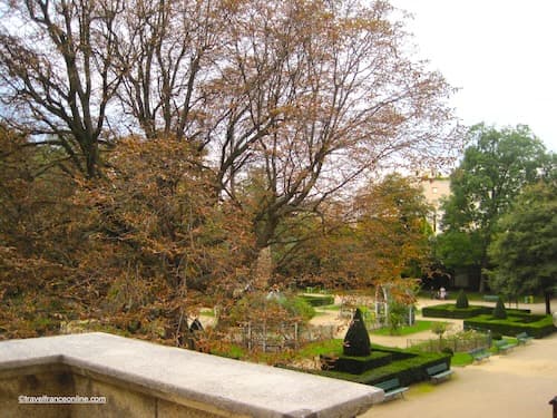
Today, it flows beneath the Square René-le-Gall, a 2,500 m² public park located south of the Gobelins Manufactory. Fortunately, the polluting workshops and industries have long since disappeared, paving the way for environmental restoration.
Encouragingly, the City of Paris is considering reopening certain sections of the river and allowing it to flow in the open air once again. Following the example of Fresnes, in the Val-de-Marne department, which reopened a 3-hectare section of the Bièvre in the Parc des Prés in the early 2000s, it is hoped that Paris will follow this example to revitalise the landscape of this neighbourhood.
Directions: 13th District – 42 Avenue des Gobelins
Metro: Gobelins on Line 7
Coordinates: Lat 48.835254 – Long 2.352458
Photo Wikimedia Commons: Gobelins in 1830 Public domain


