
Bassin de la Villette
The Bassin de la Villette forms a vital link between the Canal de l’Ourcq and the Canal Saint-Martin.
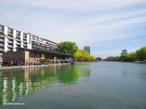
This 800 metres long and 70 metres wide artificial reservoir begins at the Pont de Flandre, a swing-bridge connecting the Place de Biche to the Rue de Crimée. It extends to the Place de Stalingrad, a square dominated by the elegant Rotonde de la Villette.
Inaugurated on December 2, 1808, the anniversary of Napoleon’s coronation, the Bassin de la Villette was initially designed to store water to supply Paris’s public fountains, street pumps, and sewers via an extensive network of canals.
Today, it serves as a marina for river cruises in Paris and is thus an integral part of the Parisian Canals, a 130-kilometre-long network of waterways: the Ourcq Canal, the Saint-Denis Canal, the Saint-Martin Canal and the Arsenal Canal.
Canal de l’Ourcq
The 96.6 kilometres long Ourcq Canal was built between 1802 and 1826 and was inaugurated on the same date as the Bassin de la Villette.

It was initially intended to supply Paris with drinking water from the Marne River and its tributary, the Ourcq. Today, it exclusively supplies the Parisian canals. With a 15-metre drop in elevation, the canal requires numerous locks to allow barges to pass through to the Bassin de la Villette, where it flows into the river.
The banks of the Ourcq Canal and the Bassin de la Villette underwent significant rehabilitation and landscaping work in the 1990s. As a result, it now boasts numerous green spaces dedicated to various recreational activities, such as cycling and hiking. You can also relax on benches in the shade of the trees, stroll through the weekly flea market or watch the fishermen (a fishing license is required).
Directions: 19th district – Place de Stalingrad
Metro: Stalingrad on Lines 2,5,7 or Jaurès on Lines 2,5,7bis
Coordinates: Lat 48.884709 – Long 2.371603


