
Monpazier, ranked among the Plus Beaux Villages de France
Monpazier is a magnificent bastide town nestled in the heart of the Périgord region, about 50 kilometres southeast of Bergerac and southwest of Sarlat-la-Canéda.

Monpazier is considered a true jewel of medieval heritage for its exceptional beauty and architectural integrity. It indeed stands out from other bastide towns due to the exceptional preservation and restoration efforts undertaken, that make it the best-preserved bastide town in Southwest France.
It is thus listed among the Plus Beaux Villages de France – Most Beautiful Villages in France and is classified as a Grand Site National – Grand National Site.
Monpazier is a remarkable example of a bastide town and boasts an impressive collection of 32 buildings listed as historical monuments.
Monpazier, an English bastide
King Edward I of England founded Monpazier in the 13th century after the signing of the Treaty of Paris, on land belonging to Pierre de Gontaut, Lord of Biron.
Known as Castrum Montis Pazerii, or Fortress of Mount Peace, Monpazier enjoyed a period of prosperity under English rule.
It returned to French control in the 1370s, during the reign of Charles V, when his troops reconquered the Périgord.
With its relatively modest area of 53 hectares, Monpazier is the smallest commune in the Dordogne.
Monpazier today
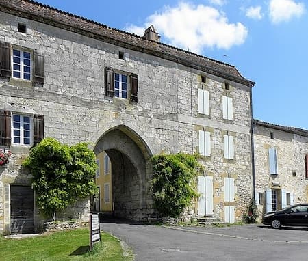
Two fortified gates provide access to the bastide town of Monpazier.

The bastide is laid out on a rectangular plan, 400m in length and 220m in width, and is divided into four distinct districts, each delimited by four main streets that intersect at right angles. The bastide is centred around the iconic Place des Cornières, the covered market square, known as La Halle, which has retained its original 16th-century wooden frame, supported by sturdy limestone bases.
This central square is surrounded by houses supported by vaulted porticoes, locally called cornières, hence its name. The covered arcades, lined with shops and restaurants, come alive on market days, their stalls stretching as far as the eye can see.
Built between the 13th and 17th centuries, the houses of Monpazier are renowned for their uniform size, reflecting the original urban plan of the bastide. Narrow alleyways, or andrones, run between these houses, and were deliberately narrow to limit the fires so common in the Middle Ages.
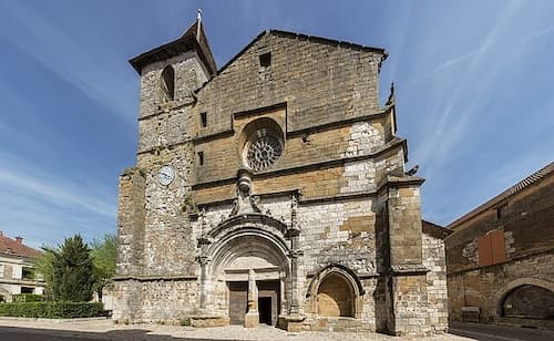
The Church of Saint-Dominique is among the first buildings constructed in the 13th century.
It has obviously undergone modifications and expansions over the centuries to adapt to population growth and the evolving needs of the community, but has retained its original and spectacular architecture. It escaped destruction during the French Revolution because it was converted into a barn.
The Maison du Chapître (Chapter House), a three-story limestone structure also dating to the 13th century, is next to the church.
Monpazier is, indeniably, one of the must-see towns of the Périgord region.
Department of Dordogne
Coordinates: Lat 44.682654 – Long 0.895369
Photos via Wikimedia Commons: Header and Photo4 by GO69 CC BY-SA 4.0 – Place des Cornières and Arcade by MOSSOT CC BY 3.0 – St Dominique Church by Mairiemonpazier CC BY-SA 4.0


