
Rock shelters
The rock shelters of Laugerie Basse and Laugerie Haute are located in Les Eyzies-de-Tayac-Sireuil, on the right bank of the Vézère , along the D47 road leading to Périgueux.

Over millennia, the river has carved into the limestone cliff, forming a series of cavities. These two shelters, due to their exceptional configuration and location, were inhabited continuously for 25,000 years, from the Aurignacian to the Magdalenian.
However, part of the overhanging cliff has collapsed due to natural erosion and seismic activity, and imposing limestone boulders are blocking the entrances. Paradoxically, this collapse also protected the shelters from erosion, thus preserving many archaeological remains.
The limestone environment favoured the fossilisation of these artefacts, leaving intact traces of human occupation spanning 25,000 years, throughout the Upper Palaeolithic (approximately 37,000 to 10,000 BC).
This uninterrupted accumulation of remains has allowed archaeologists to understand the way of life and rituals of the ancient populations who inhabited these shelters.
La Laugerie Basse
The prehistoric site of La Laugerie Basse is approximately 50 metres long and 15 metres deep. It includes two rock shelters, the Abri Marseille and the Abri Classique.
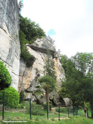
The first excavations were carried out by Édouard Lartet in 1863, but the systematic and precise recording of the strata was not completed until 1921. Laugerie Basse is widely considered by archaeologists to be an exceptional site due to the richness and quality of its discoveries.
Nearly 600 artefacts, including tools, bone and antler art objects, flints, rock engravings and remains of dwellings, have been unearthed at this single site. Human bones exhumed from the site revealed that the bodies of the deceased were painted with ochre before their burial, and placed facing east.
Among the most remarkable discoveries are a headless female statuette nicknamed the Vénus Impudique (Impudent Venus) because of her broken head) and an engraved plaque entitled La Femme au Renne (Woman with the Reindeer), both dating from the Magdalenian period.
These objects undeniably testify to the existence, extent, and refinement of prehistoric art. A small museum has been set up near the Abri des Marseilles. It offers videos, photos and numerous casts, highlighting the finds made at the site.
La Laugerie Haute
La Laugerie Haute rock shelter is located a few hundred meters farther along the cliff. It extends for about 200 metres, and is one of the largest prehistoric rock shelters in the Vézère Valley.
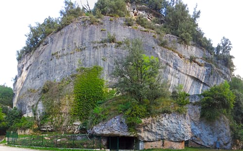
Like La Laugerie Basse, traces of human occupation dating back 25,000 years have been unearthed, including two human skeletons and numerous exceptional tools, bone objects and works of art on stone, such as engravings and sculptures. Remarkably, the outer wall of the shelter was cleverly shaped to divert rainwater and prevent it from seeping into the cavity.
Excavations have also revealed artefacts on the riverbank, indicating an area of human occupation extending up to 1,000 metres around the shelter. The site of La Laugerie Haute was first excavated in 1863, then several times in 1911, 1921, from 1936 to 1939, and finally in the early 1990s.
La Laugerie Basse and La Laugerie Haute were listed as Historic Monuments on April 25, 1940, designated Archaeological Sites on December 5, and inscribed on the UNESCO World Heritage List in 1979. The Dordogne department acquired La Laugerie Basse in 2011, while La Laugerie Haute is open to the public but can only be visited on guided tours organised by the National Monuments service.
Department of Dordogne – Les Eyzies de Tayac Sireuil
Laugerie Haute: Lat 44.952526 – Long 1.001166
Laugerie Basse: Lat 44.950909 – Long 0.999127
Credit: Photo3 from Donsmaps


