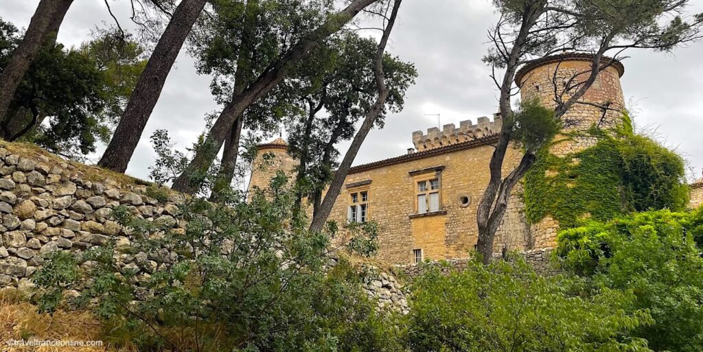
The 5 Knights Templar Commanderies in Aveyron
The Knights Templar founded five command posts or commanderies in the Larzac plateau, on land donated by the King of France and powerful lords: Sainte-Eulalie-de-Cernon, La Cavalerie, La Couvertoirade, La Tour-Grenier du Pas-de-Jaux, and Saint-Jean d’Alcas.
These commanderies were intended to generate income to finance the protection of crusaders on their journey to the Holy Land and to support them in the Kingdom of Jerusalem. Each has its own distinct character, and all are formidable fortresses.
Knights Templar Commanderies – Sainte-Eulalie-de-Cernon
Sainte-Eulalie-de-Cernon served as the headquarters of the Order of the Knights Templars in the Larzac. In 1153, the Abbot of Saint-Sauveur de Gellone donated the church of Sainte-Eulalie to the Templars. However, the Templars founded the commandery in 1159, when the King of Aragon and Count of Barcelona granted them the entire village of Sainte-Eulalie, as well as the right to build on the Larzac plateau.

They began by enlarging the old church and establishing their commanderie in the heart of the village. Quadrilateral in shape, it was bordered on one side by the village square and flanked at each corner by square towers, except for the corner adjoining the church.
The buildings facing the square housed the knights’ dormitory and refectory. The commander resided on the upper floor of this building. The servants’ quarters, stables, barns, sheepfolds, forge, and other farm buildings were located in the remaining buildings.
Located in the charming Cernon Valley, 15 km southeast of Millau, Sainte-Eulalie-de-Cernon is one of the best-preserved commanderies in France. It has indeed retained all its picturesque charm, nestled behind its thick ramparts. Around every corner of a maze of charming alleyways, watchtowers, turrets, and staircases are revealed, adorning the old houses connected by covered passageways and inner courtyards.
The Place du Commandeur, as its name suggests, was the heart of the village. It is still dominated by the church, whose portal is surmounted by a statue of the Virgin Mary. The church was originally accessed through the inner courtyard of the fortified commanderie. The entrance was moved to its current location in the 17th century to facilitate access for the villagers. The monastic quarters were rebuilt, and the first side chapel was constructed at that time. The other chapels were built in the 19th century.
An elegant 17th-century fountain, surrounded by centuries-old trees, marks the centre of the square. They offer shade and coolness during the hot, dry summers. The thick rampart built to protect the village from the mercenaries and pillagers who roamed the region during the Hundred Years’ War (1337-1453) is practically intact!
Finally, you probably wonder why the church was already dedicated to Sainte-Eulalie. The reason is that the village’s first owner was Raymond Berenger, King of Aragon and Count of Barcelona, and Saint Eulalia was the patron saint of Barcelona. She lived in the 3rd century and was martyred at the age of 12. Her feast day is celebrated on February 12th.
Coordinates Sainte Eulalie de Cernon: Lat 43.982347 – Long 3.134582
Knights Templar Commanderies – La Cavalerie
The Knights Templar founded La Cavalerie in 1154, along the ancient road crossing the Larzac plateau from north to south, leading travellers to the Mediterranean ports. In its early days, the town consisted of two villages: La Cavalerie Vieille in Lestrade and La Cavalerie Neuve, on the site of the present-day town.

The Templars eventually abandoned Lestrade, likely because it belonged to the neighbouring town of Millau., and relocated the villagers to La Cavalerie Neuve, merging the two communities into a single, prosperous settlement.
La Cavalerie was then known as La Cavalaria, an Occitan name reflecting its role in horse breeding, an essential resource for the Templars. The first written record of the commandery dates to 1180, when the Templars built the Church of Sainte-Marie and an adjoining fortified house, which no longer exists. The complex was carefully laid out around an inner courtyard, the heart of which comprised the church, farm buildings, a square tower, and the knights’ quarters. Today, the few vestiges of this fortified house are incorporated into neighbouring houses: one has a projecting stair tower, the others remnants of the foundations and structures.
La Cavalerie was an annex of Ste-Eulalie de Cernon, and thus the second important commanderie in Aveyron. A prosperous agricultural settlement, it boasted in 1307 an impressive flock of 1,725 sheep! The Hospitallers inherited the Templars’ estate after the dissolution of the order in 1307, and continued expanding the domain over the decades. They surrounded La Cavalerie with a rampart in 1435, during the Hundred Years’ War.
The church square’s bell tower was integrated into the fortifications, forming a trapezoidal enclosure flanked by four round towers at each corner. However, the commanderie was pillaged during the Wars of Religion in the 16th century, and the fortified house was destroyed. The round towers were lowered and demilitarised in the years that followed.
Prosperity returned a century later with the opening of a road linking the northwest and south of the Larzac plateau. This major road facilitated trade and necessitated the construction of a coaching inn. The inn acted as a catalyst for the region’s development, attracting the establishment of inns and taverns to accommodate travellers. True to its reputation, the village continued to provide fresh horses for riders to continue their journeys!
Merchants, prominent citizens, and traders settled in La Cavalerie, transforming it into a prosperous town. The vestiges of this golden age are still visible in the elegant townhouses and bourgeois homes surrounding the Place des Templiers and the Place de l’Église. These 17th- and 18th-century buildings escaped destruction during the French Revolution because they were declared public property and sold.
The current Notre-Dame du Larzac church was built in the 18th century. However, it has retained its magnificent vaulted nave, shaped like a sheepfold, a vestige of the former Templar church.
As for the post house, originally a large barn (or jasse in Occitan), it has been superbly restored and now houses the town hall. La Cavalerie received a heritage award for the restoration of its impressive fortified walls, towers, ramparts, and imposing gate, which were listed as historical monuments in 1998.
La Cavalerie is located approximately 20 km south of Millau.
Coordinates La Cavalerie: Lat 44.008658 – Long 3.156582
Knights Templar Commanderies – La Couvertoirade
The exact date of the founding of the La Couvertoirade commanderie remains unknown. However, it is known that in 1181, a local lord ceded his rights to a farm, Mas d’Aymar, to the Templars of Sainte-Eulalie-de-Cernon.
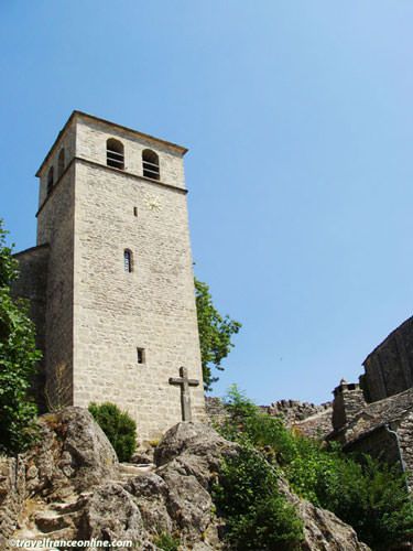
Documents dating from 1249 attest to the existence of the fortress (and not simply a fortified house) that the Templars built on this rocky spur. This fortress comprised a keep, a main building, a chapel, and a lower courtyard. It served to protect the villagers from raiders, as the village lay outside its walls. The presence of a barbican and a breach above the entrance gate confirms its defensive function.
The village chapel was also located beyond the ramparts, nestled in the woods at the foot of the hill near the Moulin de Rédounel (mill). The Hospitallers built the Church of Saint-Christol on the foundations of the Templar chapel, which had become too small in the 14th century to accommodate the growing population. The new parish church remained dedicated to Saint Christopher of Lycia, patron saint of travellers.
The Hospitallers also erected the impressive ramparts in 1439 (during the Hundred Years’ War) at the request of the villagers, who sought protection from the brigands and marauders ravaging the Larzac plateau. These well-preserved fortifications boast 1,30-m-thick walls and extend for 420 metres. They are pierced with arrow slits and topped with a parapet walk.
The Hospitallers incorporated the flat apse of the church into this rampart and built a defensive tower above the chancel. However, this tower was dismantled in the 18th century because its weight threatened the structure. The church was renovated in the 19th century. One of its most remarkable features is a sculpted keystone adorned with a Maltese cross. The Church of Saint-Christol in La Couvertoirade and its old cemetery were listed as historical monuments in 1945.
The cemetery, still enclosed within its original perimeter wall, contains several discoidal tombstones. This distinctive funerary style, originating in Syria, was most likely introduced to the region by returning crusaders. The construction of the ramparts in the 15th century divided the cemetery into two, creating a new cemetery outside the walls.
La Couvertoirade has been ranked among the Plus Beaux Villages de France – Most Beautiful Villages of France since 1982 for the quality of its 16th- and 17th-centuries architectural heritage and its state of preservation.
This past prosperity is evidenced by the numerous knights’ houses whose facades still display their coats of arms and the elegant stone houses. One of the most remarkable buildings is the Maison de Scipione, a 15th-century bourgeois residence adorned with a superb mullioned window and a turret added in the 17th century. This building named after the widow of Sieur Scipion Sabde, known as La Scipione, now houses the Tourist Office. Its ground floor boasts a magnificent vaulted room, formerly a sheepfold (a typical layout for the region). A spiral staircase leads to the walking path, which offers spectacular views of the village and its surroundings.
The Hospitallers granted the villagers access to the communal bread oven. Restored in 2000, this 15th-century oven is in working order, and the village baker regularly bakes his bread in it.
Proper water management was vital in this arid region, often plagued by drought. All buildings, houses, and sheepfolds were thus designed with gutters that channelled rainwater into cisterns, ensuring a constant supply. Circular, paved basins, known as lavognes, collected rainwater for the sheep. The lavogne at the edge of the village even collected runoff from the nearby Colline du Puech (hill).
A visit to La Couvertoirade would be incomplete without mentioning the Moulin Redounel, the windmill that overlooks the village from the top of the neighbouring hill. The commanderie once operated two windmills, including the now-vanished Moulin de la Croix du Vent, which was still standing in the 17th century. The Redounel mill is the only remaining mill in La Couvertoirade and one of the few vestiges of the sixty windmills once recorded in southern Aveyron!
In the Middle Ages, mills were essential for grinding wheat into flour and for crushing walnuts to produce oil, and apples for cider. As you can see, like other the commanderies, La Couvertoirade was a self-sufficient community that functioned harmoniously for generations.
Coordinates La Couvertoirade: Lat 43.912943 – Long 3.316610
Knights Templar Commanderies – Le Viala-du-Pas-de-Jaux
The Hospitallers built the granary tower of Viala-du-Pas-de-Jaux in the 15th century. This tower served as both a hayloft and a barn, as well as a refuge for the villagers in times of war, when pillagers and soldiers roamed.

The origin the estate goes back to 1150, though, when the Templars received the lands of Vialaret as a donation. This vast agricultural estate comprised Viala Bas and Viala Haut, as well as two large neighbouring estates: Fraissinel and Grange de Gals. This estate was under the authority of the commanderie of Sainte-Eulalie de Cernon. The income derived from farming and livestock was used to finance their expeditions to the Holy Land and the knights’ stay in the Kingdom of Jerusalem. When the Hospitallers of St. John of Jerusalem took possession of the estate in 1314, they combined Fraissinel and Gals into a single estate, Viala, and built the church and their living quarters.
Although the Hundred Years’ War was drawing to a close in 1430, the Larzac region was insecure. Bands of demobilised soldiers, known as routiers, continued to pillage and burn villages. As a result, the commander of Sainte-Eulalie authorised the villagers to erect a fortified tower at Le Viala. Until then, the inhabitants had to flee on foot to Sainte-Eulalie with their families and livestock, a perilous 10-kilometre journey.
The 30-m-high tower at Le Viala-du-Pas-de-Jaux is the tallest in Aveyron and is known as the Larzac lighthouse. Its upper terrace and walkway indeed provided a 360-degree panoramic observation post. Sentries could thus spot attackers from afar, giving the villagers time to prepare.
Each level had a specific function. The ground floor housed the stables, and a large cistern at the rear collected rainwater. The upper floors were used to store fodder and straw, and the first floor, connected to the knights’ pavilion by a drawbridge, offered maximum security.
The granary tower was abandoned after the Revolution and gradually fell into ruin. Fortunately, a local association, created in 1981, purchased the dilapidated buildings. It undertook extensive restoration work that restored the tower to its former fortified appearance, five floors, a machicolated parapet walk, adjoining buildings, as well as the Lodge of the Knights Hospitaller of St. John of Jerusalem and the barn. T
oday, the tower is an exhibition centre. Each level is dedicated to different aspects of the Larzac’s agricultural and pastoral traditions during the Middle Ages. Its rooftop terrace, now devoid of any defensive function, offers a breathtaking view of the picturesque village, with its old Caussenard farmhouses, slate roofs, walled gardens, and 19th-century church.
As for the name: Viala is the Occitan form of the Latin Villa, a large rural estate (called Ville in northern France). Pas was an old word for Pass, a perfectly logical name, as Le Viala lies at the heart of a glacial cirque. Pas du Viala, with its gentler slope, was therefore more accessible. As for the origin of de Vaux, it is much more uncertain. Many believe it refers to an ancient temple dedicated to Jupiter, once locally known as Jovis.
Le Viala-du-Pas-de-Jaux is located approximately 10 kilometres from Sainte-Eulalie-de-Cernon.
Coordinates Le Viala du Pas de Jaux: Lat 43.956993 – Long 3.056391
Knights Templar Commanderies – Saint-Jean-d’Alcas
Although often mistaken for a Templar city, as it is located on former Templar territory, the fortified village of Saint-Jean d’Alcas was actually built by the abbesses of Nonenque Abbey. Considered a jewel of Cistercian architecture, it is also known as the Fort des Dames (Ladies’ Fort). It is also often compared to the Templar city of La Couvertoirade for its excellent state of preservation and architectural richness.

In 1153, Saint-Jean d’Alcas was merely a farm and its hamlet and its 8th-century church, dedicated to Saint John the Baptist. The name “Olcas,” meaning “arable land” in Occitan, aptly described the quality of the local soil, ideal for farming and livestock breeding. This was enough to arouse the covetousness of the local lords!
The church and hamlet came under the ownership of the Cistercian priory of Nonenque at the end of the 12th century. The priory’s influence grew as it acquired new lands, eventually leading to its recognition as an independent abbey. As a result, the abbess became the feudal lord of the village.
Around the same time, Sainte-Eulalie-de-Cernon, the main commanderie of the Knights Templar in Aveyron, inherited lands and rights in the commune of Saint-Jean d’Alcas. This inevitably led to conflicts between the Templars, the villagers, and the neighbouring abbey of Nonenque.
In the 14th century, the Knights Hospitaller inherited the Templar possessions, including the lands of Saint-Jean d’Alcas! In 1321, tensions were so high that the Abbess of Nonenque allied with the King of France to protect her lands from the local lords and the Hospitallers.
However, they soon faced a new challenge in 1337 with the outbreak of the Hundred Years’ War. Twenty years later, the abbess authorised the villagers to raise the height of their church to add a fortified refuge where they could take shelter from pillagers and invaders.
In 1439, the Hundred Years’ War was slowly drawing to a close, but attacks on the Larzac plateau remained a serious threat. The village’s defences needed strengthening! Once again, the abbess authorised the villagers and peasants of the surrounding area to build a fortified enclosure around Saint-Jean d’Alcas to protect themselves and their livestock. The fortified church and the refuge were integrated into the fortifications, which were constructed within a period of four years.
The bands of pillagers and brigands who roamed the Larzac plateau never managed to breach this formidable wall or capture the fort. Indeed, the 62.5-m-long and 37-m-wide rampart was flanked by four corner towers. It also rose to a height of over 10 metres, with 1.5-m-thick sections, and completely encircled the village.
The fort thus withstood the siege led by the Protestants in 1573, after the nuns poisoned two of their leaders. The Huguenots retaliated by burning down Nonenque Abbey, forcing the nuns to take refuge in Saint-Jean d’Alcas, where they remained throughout the siege and the reconstruction of their abbey.
The Pourtal, the impressive main entrance, still provides access to the fortified village, renowned for its remarkably well-organised layout and harmonious proportions. The two parallel cobbled streets that run the entire length of the rectangular fort are connected by four narrow alleyways. They are lined with small, identical houses with elegant mullioned windows, and perfectly illustrates the influence of the Cistercian order in the Middle Ages.
The sober and elegant architecture, as well as the peaceful atmosphere of the 13th-century church, illustrate the understated medieval monastic architecture. The Tour Poivrière (Pepperpot Tower) provides access to the upper parts of the church, including the presbytery, the refuge, and the rampart walk. The latter offers exceptional panoramic views of the foothills of the Larzac plateau, the cirques of Saint-Paul-des-Fonts and Tournemire, the Combalou mountain, and the Lévézou massif.
Saint-Jean d’Alcas officially became a commune in 1789 (French Revolution), thus ending the presence of the nuns. Since the 1970s, the villagers have embarked on restoring their magnificent fort, considered a superb example of the Causses architecture.
Saint-Jean d’Alcas is located at the western edge of the Larzac plateau, about fifteen kilometres from Saint-Affrique and 10 km from Roquefort-sur-Soulzon, where the famous Roquefort AOC cheese is produced.
Coordinates Saint Jean d’Alcas: Lat 43.927952 – Long 3.005134
Tip: With careful planning, the visit to the five Knights Templar Commanderies in Aveyron can be comfortably completed in a day.
Department of Aveyron