
Les Monts Dore, a volcanic mountain range
The Monts Dore are a collection of ancient volcanoes nestled in the heart of the Auvergne Volcanoes Regional Natural Park. This geological marvel is the remnant of the caldera of a massive stratovolcano, formed during a cataclysmic eruption approximately 3 million years ago. Over millennia, successive eruptions occurred in various parts of the caldera, giving rise to four distinct groups of volcanoes.
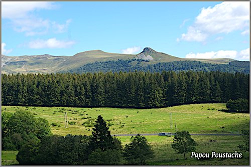
1- The Sancy Massif emerged approximately 2 million years ago. Its highest point, the Puy de Sancy, rises to an impressive height of 1,885 meters, making it the highest volcano in France. Through successive eruptions, lava flows, and glacial erosion, the Sancy Massif has undergone a radical transformation, sculpting landscapes of exceptional diversity and beauty over millennia. From rounded peaks to steep ridges, jagged crests, glacial valleys, and crater lakes, the massif offers a breathtaking natural panorama.
2- The Massif Adventif, located northwest of the Sancy massif, reaches its highest point at 1,738 meters with the Puy de l’Angle. Other notable peaks include the slightly lower Puy de Barbier (1,702 m), the Puy de Monne (1,692 m), and the Puy de la Tache (1,629 m). Despite its proximity, this volcanic chain is distinct from the Sancy massif, having been formed by intense eruptions less than a million years ago. Shaped by glacial erosion, the Massif Adventif offers rugged landscapes characterised by steep peaks and spectacular waterfalls, which contribute to its charm and beauty.

3- The Banne d’Ordanche rises to 1,512 meters. This volcano, formed approximately 2 million years ago, is located on the northern rim of the Monts Dores caldera. Its unique structure is the result of two geological processes: first, the lava solidified in the volcano’s vent before being ejected, and then glacial erosion wore away the surrounding softer rock, leaving behind the characteristic lava column. Its name comes from its striking horn-like shape, as “banne” means “horn” in the Auvergne dialect.
4- The Puy de l’Aiguiller, reaching a height of 1,525 meters, is located north of Sancy and remains one of the lesser-known volcanoes in the Monts Dores massif. These remarkable Monts Dores take their name from the tulmutuous Dore River, which rushes down the slopes of the Puy de Sancy. The Dore then joins another Sancy mountain stream, the Dogne, to form the famous Dordogne River!
4- Puy de l’Aiguiller (1525 m) is located north of Sancy and is the least known of the Monts Doré. These impressive volcanoes take their name from a stream, the Dore, which rushes down the slopes of Puy de Sancy; the Dore then joins the Dogne, another Sancy mountain stream, to form the Dordogne River!
Les Monts Dore, a land of water
The Monts Dore, renowned for their abundance of water, are part of the Massif Central, a region often called the “Water Tower of France” due to the multitude of streams, springs, waterfalls, and lakes found there.
Among these natural wonders are crater lakes such as Lac Pavin, Lac Chauvet, and Lac Serveries, but also glacial lakes such as Lac Bourdouze; Lacs Chambon, Guéry, and Montcynère, which were formed by the volcanic obstruction of ancient rivers.
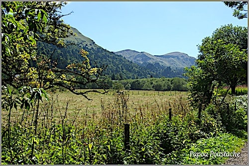
The region’s volcanic and geothermal activity has enriched the soil with minerals and gases, thus creating thermal, hot, ferruginous, or saline waters, renowned for their health benefits. Ancient cultures, notably the Celts and Romans, discovered the therapeutic benefits of hydrotherapy, a tradition that persisted throughout the Middle Ages and experienced a resurgence in popularity in the 19th century.
During this period, spa towns like Le Mont-Dore and La Bourboule emerged, attracting French and European nobility seeking rejuvenation. To accommodate this influx of visitors, hotels, health centres, and casinos were built. The springs of Mont-Dore, with temperatures ranging from 38°C to 44°C, are particularly renowned for their effectiveness in treating pulmonary and rheumatic ailments, thanks in particular to their high silica and carbonic acid content.
At an altitude of 1,220 meters, the Source de la Montille, operated by the Compagnie des Sources du Mont-Dore, provides drinking water recognised for its purity and therapeutic properties. As for the Source Saint-Nectaire, known since antiquity, it gushes forth at 56°C and offers therapeutic benefits for kidney ailments. Saint-Nectaire seems blessed, not only for its medicinal springs, but also as the birthplace of the delicious St-Nectaire AOC cheese.
Ski in winter, hike in summer in Les Monts Dore!
The Monts Dore ski area was the third established in France. Welcoming visitors since 1936, it consistently ranks among the top four off-piste skiing destinations. The ski area sits between 1,050 m to 1,846 m in altitude, and occupies the northern slopes of the Puy de Sancy and Puy de Ferrand, while Super Besse (at altitude of between 1,300 m and 1,846 m), lies on the eastern slope of the Puy de Ferrand. Linked together, they form the vast Grand Sancy ski area.
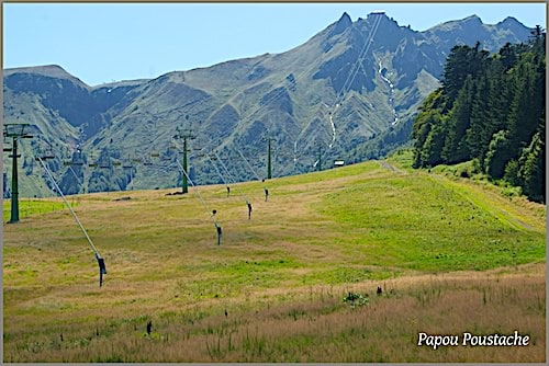
The charming resort of Chastreix-Sancy, nestled between 1,400 m and 1,850 m in altitude on the western slopes of the Sancy Massif is part of the Monts Dore ski area. Its orientation, however, exposes it to oceanic influences, which can sometimes disrupt the operation of the ski lifts. Despite this, Chastreix-Sancy remains a prime destination for winter sports enthusiasts.
The Monts Dore area is also crisscrossed with an extensive network of marked hiking trails (GR) that allow visitors to immerse themselves in the breathtaking landscapes of this remarkable volcanic region.
Among its must-sees is the Chaudefour Valley, one of the three glacial valleys of the Sancy Massif. Renowned for its stunning beauty, it features steep and jagged peaks such as the Dent de la Rancune, the Crête du Coq, and the Aiguille du Moine. Designated a National Nature Reserve in 1991, it is home to exceptional flora and fauna, as well as numerous mineral springs, including the famous Sainte-Anne Spring, known for its ferruginous waters.
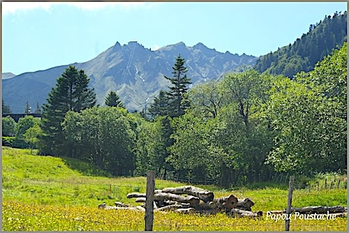
Other remarkable sites include Roche Tuilière and Roche Sanadoire, two lava columns that solidified before the eruption. Millennia of erosion have sculpted these formations, leaving behind two distinct protrusions bordered by a glacial valley. For nature lovers, the Chastreix-Sancy Nature Reserve is a sanctuary of unspoiled nature in the Vallée de la Fontaine Salée, home to exceptional flora and fauna.
Finally, experienced hikers can explore 20 trails, offering the opportunity to traverse the slopes of a volcano and admire the magnificent landscapes of the Monts Dores up close.
Department of Puy-de-Dôme – Auvergne region
Coordinates Le Mont-Dore (town): Lat 45.576611 – Long 2.808207
Credits photos: Jean Piludu @cpauvergne


