
Brittany, the core area of the megalithic culture
Carnac (Karnag in Breton) is the most famous megalithic alignment in southern Brittany. Although stone circles are rare in Brittany, the region has many alignments, as well as tumuli, dolmens and isolated menhirs.
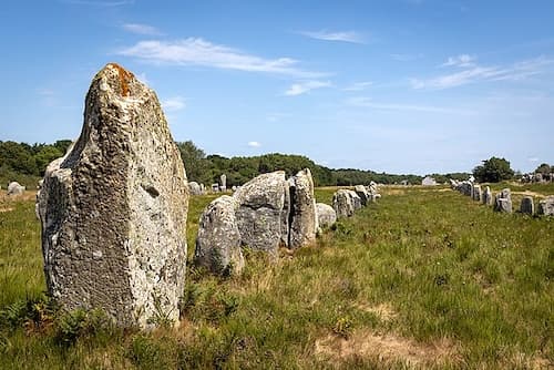
Despite their abundance, much remains unknown about the pre-Celtic populations who erected these megaliths between 6000 and 2000 BC. Their function thus remains a mystery!
Traditionally, they were thought to form a vast necropolis, each stone representing an important leader. The presence of numerous burial mounds seemed to corroborate this theory. However, a new generation of researchers is questioning this hypothesis.
They suggest instead that these alignments served another function, unrelated to the cult of the Dead. This perspective suggests that these structures were part of a vast system of astronomical instruments, similar to observatories, used to predict and record the movements of celestial bodies, including planets.
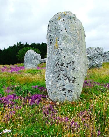
The alignment of megaliths with sunsets at the solstices is a well-documented phenomenon at Carnac, which could confirm its importance in ancient astronomical observations. Carnac indeed shares similarities with other sites in Western Europe.
According to an article published on a specialized website, calculations reveal that: “Carnac is located at the unique latitude on Earth where the sun, at both the summer and winter solstices, forms a perfect Pythagorean triangle with respect to the parallel of latitude, that is, the east-west equinoctial axis of the site. This 3:4:5 triangle is the first of the Pythagorean triangles and is found in the dimensions of the Crucuno monument.”
Another innovative theory suggests that dolmens could have served as primitive seismic detectors. Given the high seismic activity in Brittany, this hypothesis postulates that the location and orientation of the megaliths could correspond to seismic faults.
Although the true function of the megaliths remains uncertain, they unquestionably confirm Brittany’s status as the cradle of megalithic culture in France.
Carnac megaliths listed Historical Monuments
Carnac is home to the world’s largest megalithic site, with over 3,000 menhirs. While most of these megaliths are concentrated in the territory of the commune of Carnac, some are also located further east, in La Trinité-sur-mer.
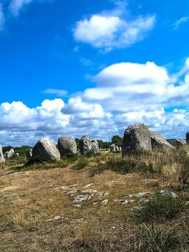
However, the grandeur of the site has not always been so obvious. When Scottish antiquarian James Miln began the first excavations in the 1860s, only 700 of the 3,000 menhirs were still standing. Miln then partnered with Zacharie Le Rouzic, who became director of the James Miln Museum after Miln’s death.
Le Rouzic continued the excavations and research until he died. In his will he had bequeathed his discoveries to the town of Carnac, which renamed the museum the James Miln – Zacharie Le Rouzic Prehistory Museum – Musée de Préhistoire James Miln – Zacharie le Rouzic.
Upon their arrival on the Breton shores in the 5th century, the Celts of Cornwall discovered the megaliths, but found no trace of their builders. Legends quickly arose to explain the origin of these enigmatic stones. Local tradition tells us that the Carnac menhirs were Roman legionaries petrified by Merlin the Magician.
Over the centuries, the Carnac alignments gradually fell into oblivion and abandonment. Many stones were moved and reused for the construction of houses and sheepfolds. Fortunately, the French state intervened at the beginning of the 20th century, acquiring the site and classifying it as a historical monument.
The four megalith sites of Carnac
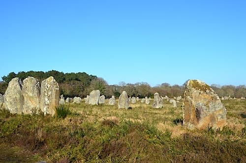
The megaliths of Carnac spread over approximately 4 kilometres on three main sites: Le Ménec, Kermario and Kerlascan, as well as a fourth smaller site, known as Le Petit Ménec.
Within each site, the height of the megaliths gradually decreases from west to east. This arrangement suggests that the four sites were once part of a single, vast complex. At the time of their construction, the sea level was approximately 9 metres lower than it is today. Vast areas, potentially inhabited, were submerged when the sea levels rose. However, despite extensive excavations, no such site has been discovered in the vicinity of Carnac.
Le Ménec
The remarkable alignments of Ménec feature eleven converging rows of 1,100 menhirs, extending over a strip of land 1.2 kilometres long and 100 metres wide, oriented from west to east. Each alignment resulted in a circle of stones, or cromlech. While 71 stones remain visible on the west side, many of those that made up the eastern cromlech have disappeared, although faint traces of their presence can still be discerned.
Kermario – The House of the Dead
The 982 megaliths of Kermario are arranged in ten rows, extending over approximately 1.3 kilometres. These rows converge towards a cromlech located to the east. Although the stone circle itself has completely disappeared, aerial views clearly reveal its foundations.
Kerlascan
Kerlascan has about 550 menhirs aligned in thirteen rows.
Le Petit Ménec
As its name suggests, the Petit Ménec alignment is significantly smaller. Located in a wooded area of the commune of La Trinité-sur-Mer, this alignment is largely hidden within dense vegetation that has invaded the site.
Tumuli of Saint-Michel and Moustoir
The Carnac region is home to many isolated dolmens and a few menhirs, and tumuli and cairns are relatively rare there.
A dolmen generally consists of three or four large standing stones supporting an imposing capstone, forming burial chambers formerly protected by a tumulus. Over time, many burial mounds have disappeared, and the soil acidity has dissolved the remains, leaving only a few traces of bones.
However, the Saint-Michel tumulus is an exception, as it has survived the centuries largely intact. Built between 5000 and 3400 BC, it is among the oldest tumuli in the world, with impressive dimensions: 125 metres long, 60 metres wide and 12 metres high. Excavations carried out in 1832 and 1907 unearthed a rich collection of funerary objects, including stone chests, jewellery, and pottery, now on display at the Carnac Prehistory Museum. The proximity of this tumulus to the Carnac alignments reinforces the hypothesis that they constituted a vast necropolis.
The second tumulus in the region, known as the Moustoir tumulus or Er Mané in Breton, is smaller but significant: it measures 85 metres long, 35 metres wide and 5 metres high at its base.
The future of the site
The Carnac megaliths were open to the public at the beginning of the 20th century. However, decades of frequent visits have had detrimental consequences, causing natural erosion that has begun to weaken the foundations of the megaliths.
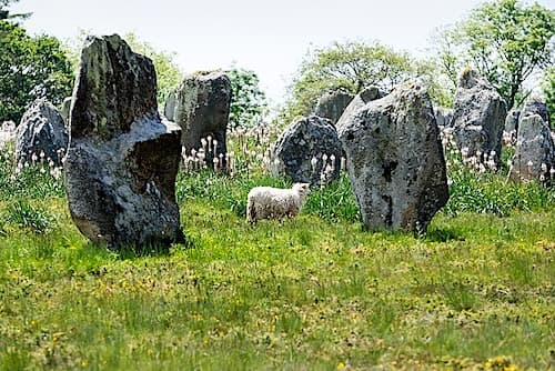
Aware of the need to preserve these ancient structures, the main sites were fenced off in 1991 to allow vegetation to grow back and to slow erosion. These fences are usually removed during the winter season.
In recent years, experimental management strategies have been implemented. One of these methods involves introducing sheep to graze among the stones, which effectively controls the proliferation of gorse and invasive vegetation. These efforts aim to find a fair balance, ensuring public access to this remarkable site while preserving its integrity.
Department of Morbihan
Coordinates: Lat 47.591266 – Long -3.082754
Photos via Wikimedia Commons: Header by Unukorno CC BY 4.0 – Le Menec ©Superbass CC BY-SA 4.0 – Kerlascan by Shonagon Public domain – Kermario by François de Dijon CC BY-SA 4.0 – Kermario menhir by Vassil Public domain – Menec menhir by Andy Hay CC BY 2.0 – Ref: * ancient-wisdom


