
Lavoûte-Chilhac – Historic village
Lavoûte-Chilhac lies on the banks of the Allier River and comprises two distinct districts: the medieval town and the “new” quarter.
Once a thriving commercial centre, it supplied the surrounding hamlets and villages of Saint-Cirgues and Bassac,. However, the town suffered an economic decline after the First World War, a decline exacerbated by the rural exodus of the 1960s. To countered this decline, Lavoûte-Chilhac created one of the region’s first holiday villages.
In recent years, Lavoûte-Chilhac has undergone significant revitalisation and modernisation efforts, such as the restoration of historical monuments, burying power lines, and paving its medieval streets. These have allowed it to obtain the prestigiousPlus Beaux Villages de France (Most Beautiful Villages of France) label.
Lavoûte-Chilhac – Medieval district
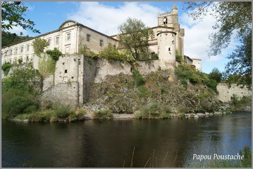
The fortified medieval quarter nestles in a bend of the Allier Gorges. The Prieuré Sainte-Croix-de-Volte was founded in 1025 on the site of the former fortress whose vestiges still overlook a bend in the Allier River.
The impressive U-shaped priory dominates the river and the historic, pedestrianised quarter. Narrow lanes, known as traboules, wind between old buildings and shops, and lead to the Place des Vieux Moulins (Old Mills Square).
Located between the river and the south facade of the Sainte-Croix-de-Volte Priory, this village square takes its name from the watermills submerged by the floods of the early 20th century.
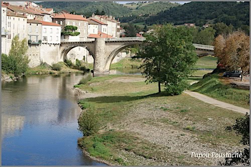
Another picturesque lane leads to the old arched bridge that connects the medieval town to the left bank. This 15th-century bridge has retained one of its original 11th-century arches and was designated a historical monument in 1926.
Lavoûte-Chilhac – ‘New’ district
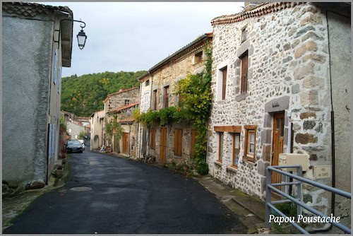
The new town developed on the left bank during the 19th century, along a single road that follows the river’s course.
It was a bustling district with shops and workshops when Lavoûte-Chilhac was a thriving commercial centre. Sadly, only vestiges of this prosperous era remain today, as many shopfronts are now incorporated into private residences.
The houses overlooking the river are generally tall, often built with two or three levels of cellars. These cellars were ingeniously designed to fill with water during the frequent floods, thus protecting the buildings’ structures from the force of the currents.
Sainte-Croix-de-Volte Priory
The history of the village of Lavoûte-Chilhac is closely linked to that of the Priory of Sainte-Croix-de-Volte.
Odilon de Mercoeur, the fifth abbot of Abbey of Cluny and a member of an illustrious Auvergne dynasty, indeed donated his lands in Lavoûte-Chilhac and Saint-Cergues to the Cluniac Order for the establishment of the priory.
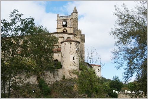
While much of the original Romanesque priory church was demolished during the priory’s reconstruction in 1460, the Porte Saint-Odilon (gate) was kept. This Gothic church boasts a magnificent polychrome cross dating from the mid-12th century, and became an important pilgrimage site after the discovery of Notre-Dame Trouvée on July 8, 1496.
The Cluniac Order undertook significant expansion work in the 18th century, that was interrupted by the French Revolution, but resumed at the beginning of the 19th century. Indeed, the imposing U-shaped priory was saved from demolition and was officially listed as a historical monument in 1862.
The legend of Notre-Dame Trouvée
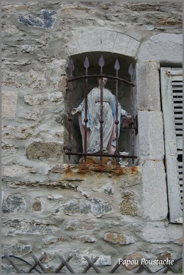
While playing on the banks of the Allier River, two little girls found a pebble whose broken lines formed the silhouette of a woman holding a child in her left arm. The bishop of the diocese of Saint-Flour immediately recognised the image of the Virgin and Child Jesus.
Soon, numerous miracles and healings were attributed to Notre-Dame Trouvée – Our Lady Found, as the the pebble became known. For centuries, pilgrims from all over France travelled to Lavoûte-Chilhac to implore the Virgin’s intercession.
Although the pebble measures only 15 mm, it now rests in a magnificent gold reliquary, the work of one of the greatest jewellers of the time, kept in the church treasury.
Notre-Dame Trouvée is still commemorated on the first Sunday of July with a procession, prayers, and a reenactment at the site of her discovery.
Tip: For breathtaking views of the town, visit the nearby hamlet of Le Bois; follow the road to Ally and turn left at the first intersection.
Haute-Loire department – Auvergne
Coordinates: Lat 45.147678 – Long 3.401795
Credits: Photos are ©Jean Piludu cpauvergne – Wikimedia Commons: Header by Calips CC BY-SA 3.0


